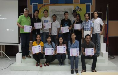
The Geosciences Division of the Mines and Geosciences Bureau Regional Office No. XIII, conducted a two-day GIS Technology Orientation and Echo of Basic Training of ArcGIS 10.1 Software Application for selected MGB RXIII GIS users on February 11-12, 2016 at the MGB-XIII Training Center in Surigao City.
The orientation and training were conducted in line with the technological innovation of Lands Geological Survey and Mapping Program of the DENR-Mines and Geosciences Bureau, Central Office towards the sophisticated adaptation on the widely embedding Geographical Information System (GIS) Technology for any scientific research study, purposely for National Disaster Risk Reduction Program of the Government of the Philippines wherein ArcGIS 10.1 is one of the powerful software applications use for this technology as the basis for geoscientific study.
The purpose of the said Orientation and Training was to further enhance the scientific understanding of participants towards Global Earth Observation System of Systems (GEOSS), only on the fields of disaster, health, and water through ocean and land based system approach. Further, the basic training on ArcGIS 10.1 software application enabled the participants to interactively navigate the earth spatial features and attributes towards realistic outcome that will be used for real and present situation decisions.
During the activity, the resource persons from the Geosciences Division were Mr. Romeo M. Dalodado, Chief, Geosciences Division; Engr. Esperidion Y. Amper, Jr., SRS I; Melvin A. Mantilla, Senior Geologist; Mr. Bryan C. Cuartero, Cartographer II. All of them were able to attend trainings related to Arc GIS and Remote Sensing in coordination with the MGB Central Office. Engr. Ernesto C. Calzar, Engr. II of the Mine Management Division, also took part in the activity as a resource person.

