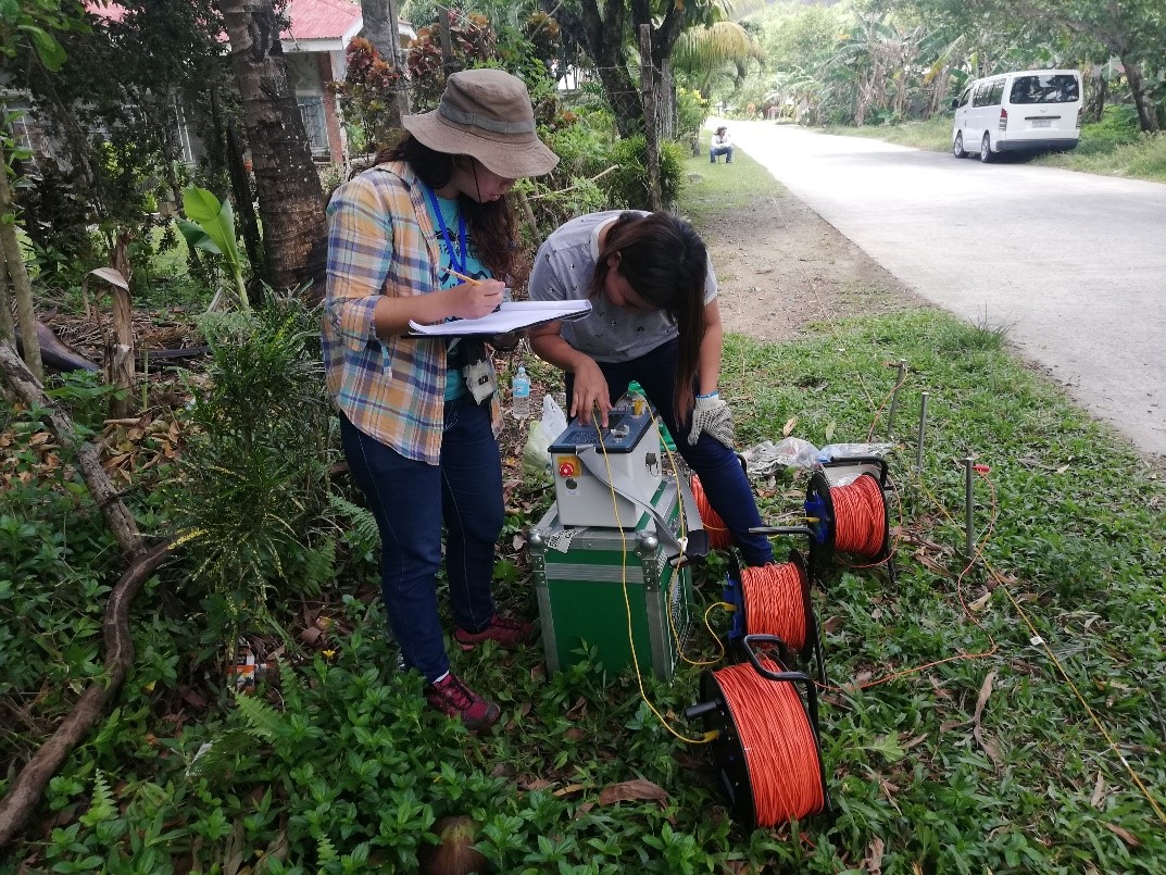
In line with the National Groundwater Resource Mapping and Assessment Program of the DENR-Mines and Geosciences Bureau, a technical team from the Geosciences Division of MGB Regional Office No. XIII carried out the 1:50,000 scale Groundwater Resource Mapping and Assessment in Malimono, Surigao del Norte from March 18 to 30, 2019. This project is the next phase after the completion of the 1:250,000 scale, province-wide Groundwater Resource Mapping and Assessment in 2018. It aims to determine the groundwater availability in relation to the local geological setting; identify potential areas for future groundwater development and/or extraction; and identify factors that may affect the water quality of the existing water supply in the target area. The said mapping activity includes field mapping such as reconnaissance geological survey and inventory of water sources (wells, springs and impounded creeks and rivers if they are used as main water sources in some continue reading : MGB ROXIII carries out 1:50,000 scale Groundwater Resource Assessment and Mapping in Malimono, Surigao del Norte